Special Weather Statements:

** A Hard Freeze continues over the north Alabama area again for your Sunday night with a mixed batch of winter precipitation coming in on Monday evening and Tuesday morning. Travel problems should be very limited as moisture will be limited, but stay with us for further updates as our experienced staff knows that winter weather can change for the worse around the the Tennessee Valley.
Local Weather Section
Light Accumulations Possible
Monday into Tuesday:

Local Radar (Courtesy of WTVA News)

Local Temperatures Map

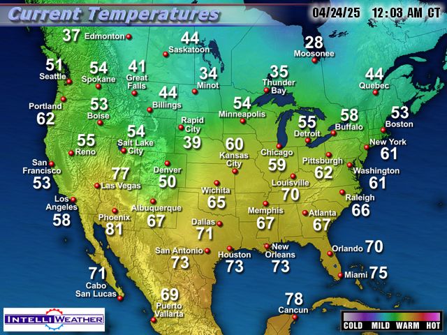
National Temperatures:
Regional In Motion Radar:

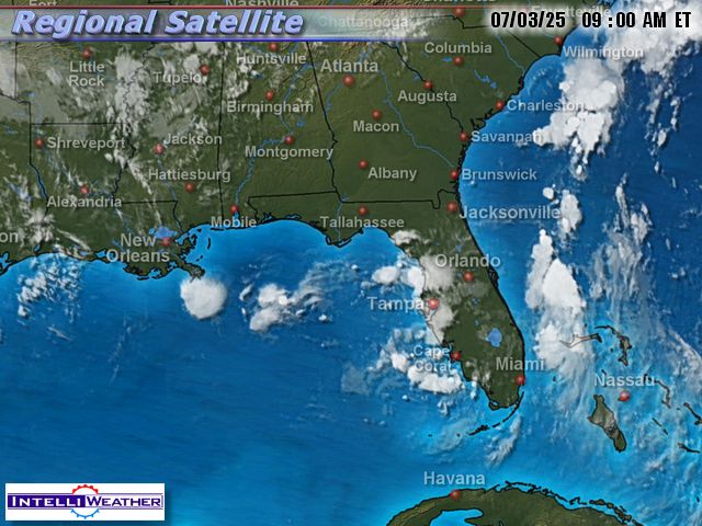
Regional Satellite View:
Short Term Local Forecast Map

This Week's Weather Story

Local Conditions/ Killen- Then Shoals

A Look To Our West:
**Refresh page for latest live snapshot**
Oxford, Ms (100 miles west of the Shoals)

Columbus, Ms (Southwest):

Near Memphis (Southaven, Ms)

Surface Map:

Surface In Motion:
Watches Or Warnings:


Solar Weather
Current Satellite View of Solar Flare Activity


Brian's Forecasting Models:
No comments:
Post a Comment