Special Weather Statements:

From Brian Davis: Storms will once again be likely on Thursday as an approaching cold front as well as a strong low level jet combined with strong upper level winds will provide enough Synoptic lift and shear for severe storms Thursday evening into Thursday night. Indicies are showing to be low right now, but as temperatures build into the mid 70s, this will help to add energy to the lower PBL which should add enough lower moisture and heat to feed the upper level wind profiles. This in turn will help lead to a few clusters of storms over the Tennessee Valley area. The greatest tornado chance will be mainly east of I-65 but this early northwest Alabama can't be completely ruled out on the threat by any means. Chances are about 5% in any given 25 square mile area. In basic terms, there should be just enough moisture and shear to help produce a few strong to severe storms over the area. The initial front that follows overnight will produce a second round of squall like storms before we begin to see a more settled weather pattern on Friday. The Weekend weather is looking really nice in general.
(Brown shaded area showing that 5% chance area
for tornado risks)

Radar network will be scanning for developing storms today:

Radar Summary of severe weather will show up here:

Watches and Warnings Will Appear left and here as well:


Local Weather Section
Local Radar (Courtesy of WTVA News)

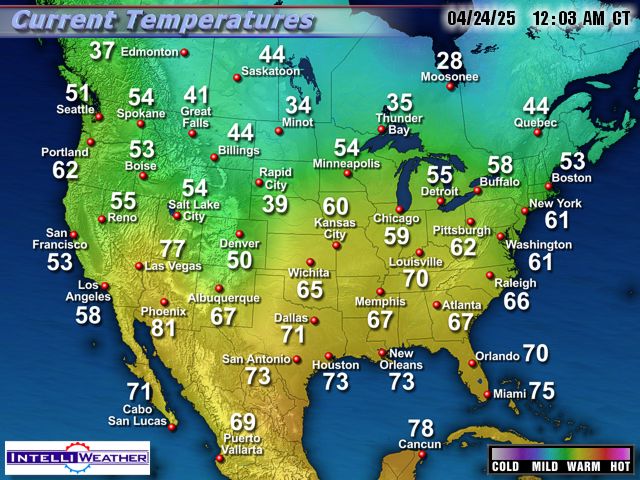
Local Temperatures Map

National Temperatures:
Regional In Motion Radar:
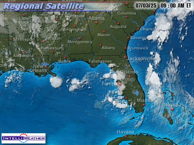
Regional Satellite View:
Short Term Local Forecast Map

This Week's Weather Story
Local Conditions/ Killen- Then Shoals

A Look To Our West:
**Refresh page for latest live snapshot**
Oxford, Ms (100 miles west of the Shoals)

Columbus, Ms (Southwest):

Near Memphis (Southaven, Ms)

Surface Map:

Surface In Motion:
Watches Or Warnings:

Solar Weather
Current Satellite View of Solar Flare Activity


Brian's Forecasting Models:
No comments:
Post a Comment